The Volvon were one of the Bay Miwok tribelets living in Contra Costa County at the time of European contact. They were a hill people based in the rugged Black Hills southeast of Mt. Diablo. The mountain itself was in Volvon hands. It had been the home of the supernatural First People, who created Indians and their world, and was a spiritual focus for nearly every tribe that could see it. Shamen and religious leaders went to the mountain to pray. Everyday people would visit its slopes for intertribal festivals. This meant the Volvon must have been a prosperous people. One did not just sashay into Volvon territory without bearing tribute for the privilege. Imagine the trade goods the Volvons acquired this way. They were regular participants in regional trade festivals hosted by their Ohlone neighbors, the Ssaoams, at the Brushy Peak trading grounds not far from the Altamont Pass. The Volvons’ preeminent position at the crossroads of Central California no doubt made them a sophisticated and cosmopolitan people.
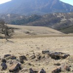
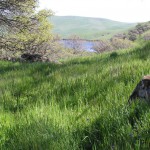
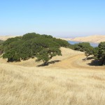
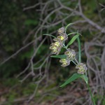
That Volvons were active traders does not mean their territory was short on natural resources. The name ‘Volvon’ itself roughly translates as “natural springs,” which befits a triblet based in the Black Hills where the headwaters of a number of perennial creeks rise. The highland heart of Volvon territory today is rich in oak, pine, and manzanita. Mount Diablo is home to a number of endemic plant species–rare resources controlled by Volvons. Open rangelands, now mostly overrun with nonnative grasses, must once have been covered with food-bearing plants. Deer, elk, and antelope were no doubt abundant in the lighly settled ridges and valleys on the eastern side of the territory.
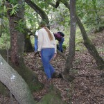
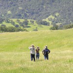
Volvon territory gives every appearance of once having supported a substantial population. We have discovered 81 bedrock mortar sites, and over 2,100 bedrock mortars. Each site carries its own sense of place and is an individual window into the past. As you walk the paths that connect these sites and build up a richer mental map and sense of the landscape, you may acquire a feeling for the possibilities of life in Volvon territory in the not so distant past.
There are magical and metaphysical powers associated with Mt. Diablo and the Black Hills. Go there now and experience its effect on your perspective. Steep yourself in prehistory. The Spanish extirpated the Volvons from their homeland 200 years ago, but physically, their territory remains virtually intact today. The land still has a life of its own.
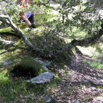
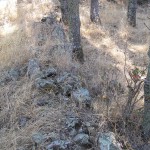
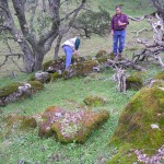
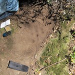
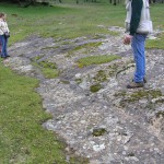
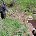
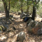
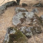
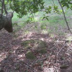
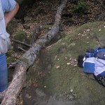
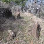
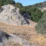
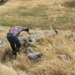
Mallory Creek #2Second Mallory Creek confluence south of Volvon Village.7 bedrock mortars, two probable mortars, and rock circles.Elevation 980 ft.This sweet site sits at a bend in Mallory Creek near an ancient trail.Check out the rocks. Do they look like they’ve been moved into place?This view looks toward Mallory Creek.This one looks away.Two mortar rocks […]
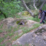
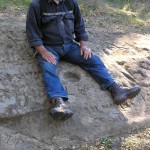
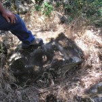
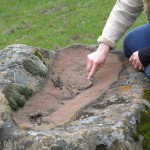
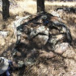
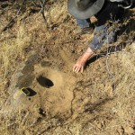
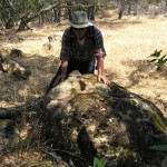
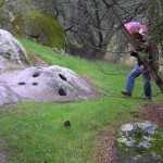
Near the top of Hog CanyonPossible bowl Metate with 3 bedrock mortarsThis is either a bowl metate, a rarity in these parts, or what Ernest Johnson in “The Stone Mortars of Contra Costa County” would classify as a type “C3” mortar. Johnson says “Type [C3], which resembles a deeply worn metate, is a true mortar, […]
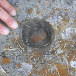
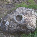
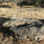
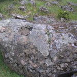
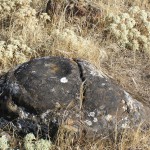
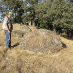
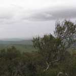
South Blue Oak Trail Ridge One bowl mortar, two probable bowl mortars and 2-3 probable bedrock mortars Elevation 2125 ft. Note the smooth, flared rim on this bowl.
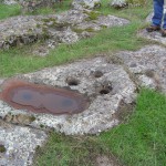
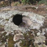
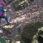
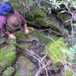
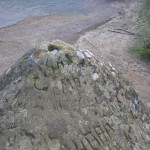
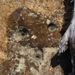
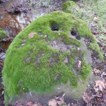
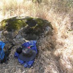
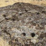
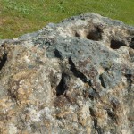
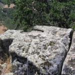
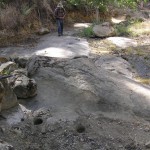
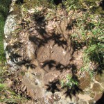
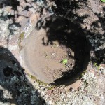
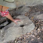
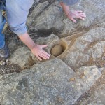
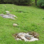
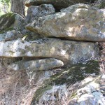
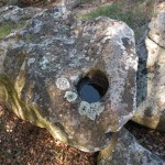
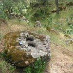
Below Cave Point11 bedrock mortars all one one rock.Think those big holes are geoconcretions? Think again. They are huge bowl mortars. Their side walls bulge out into the surrounding rock in a classic “Olla” shape–the bowl is wider at the side walls than it is at the rim. The bottoms of these bowls are basically […]
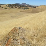
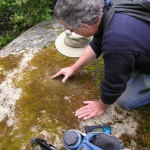
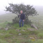
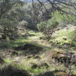
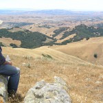
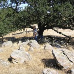
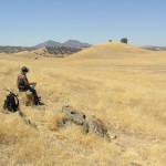
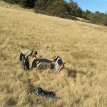
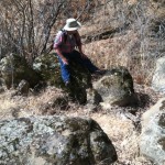
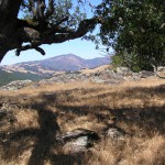
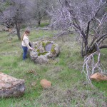
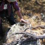
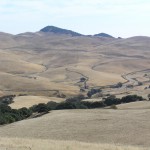
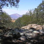
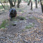
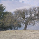
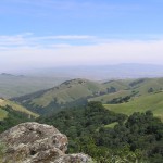
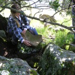
Curry Point Prayer CircleProbable prayer circle.Elevation 1778 ft.The location of this probable prayer circle is a compelling one. Mt. Diablo swallows up the view to the north. To the east, across the great valley, rise the Sierra Nevada–visible on a clear day. To the south and west lie the East Bay hills.Bob channels the spirits […]
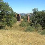
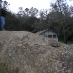
Live Oak Campground28 bedrock mortar milling station; nearby pictograph cave of probable historic origin.This settlement and the one at Rock City are the highest habitation sites in the Volvon Territory. Many ancient trails converge near Curry Point, not far from here, suggesting that these two sites sat at the gateway to the top of Mount […]
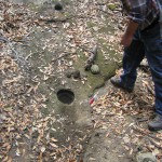
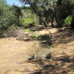
Mallory Creek #3Near the confluence of Mallory and Kellogg Creeks.10 bedrock mortars and an 8 cupule rock in the creek.Elevation 495 ft.Portions of this site may be inundated by the new high water level of Los Vaqueros Reservoir.Kellog Creek flows below us on its meander to the Delta, but instead of flowing steadily downward through […]
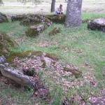
North Morgan Territory Ridge2 bedrock mortars and 4 or 5 bowls near the head of a watercourse. Probable housepits.Elevation 2112 ft.A bedrock mortar adjacent to one of the probable housepits.A big bowl.A bowl with a “fishtail” in the rim, a feature we’ve encountered at several sites in Volvon territory.Photograph by Bob Bardell.We believe the trinomial […]
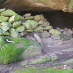
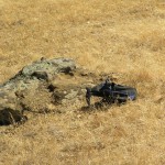
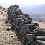
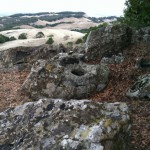
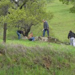
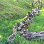
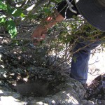
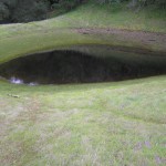
Stone Corral33 bedrock mortars, prayer circle, 2 sets of double cupules, rock wall alignments, and hunting blinds.Elevation 1800 ft.What kind of animals would be constrained by this corral? We believe the stone corral was the site of Indian games and/or ceremonies. HIke up the ridge to the west and find the spot where you have […]
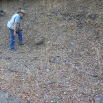
Below Knobcone Point Road21 bedrock mortars, 16 on one rock.This may have been a seasonal camp, viable when there was water flowing in the nearby branches of Sycamore Creek. The notch cut by Sycamore Creek through the Black Hills provides one of the few easy routes into Volvon territory, so this camp may have had […]