Highland Ridge Lookout
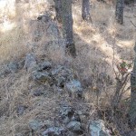
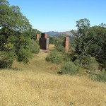
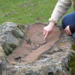
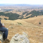
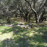
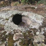
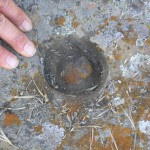
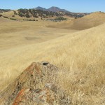
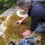
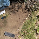
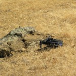
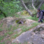
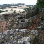
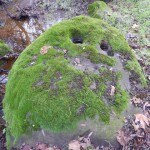
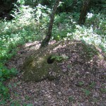
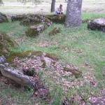
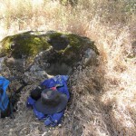
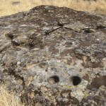
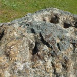
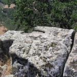
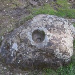
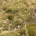
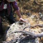
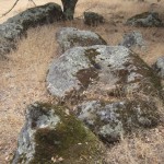
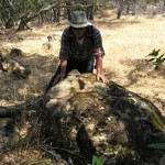
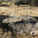
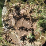
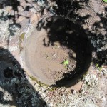
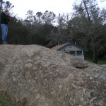
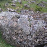
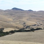
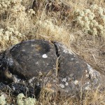
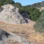
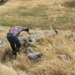
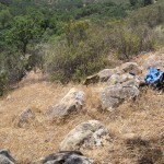
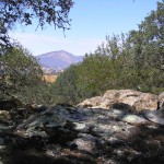
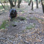
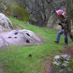
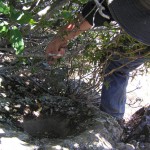
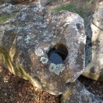
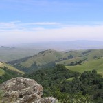
Highland Ridge LookoutOne probable bedrock mortar.The western escarpment of Highland Ridge reinforces the fortress feeling the Black Hills provide.It is unlikely that any group of people ever snuck up on the Volvons.
The Volvon were one of the Bay Miwok tribelets living in Contra Costa County at the time of European contact. They were a hill people based in the rugged Black Hills southeast of Mt. Diablo. The mountain itself was in Volvon hands. It had been the home of the supernatural First People, who created Indians and their world, and was a spiritual focus for nearly every tribe that could see it. Shamen and religious leaders went to the mountain to pray. Everyday people would visit its slopes for intertribal festivals. This meant the Volvon must have been a prosperous people. One did not just sashay into Volvon territory without bearing tribute for the privilege. Imagine the trade goods the Volvons acquired this way. They were regular participants in regional trade festivals hosted by their Ohlone neighbors, the Ssaoams, at the Brushy Peak trading grounds not far from the Altamont Pass. The Volvons’ preeminent position at the crossroads of Central California no doubt made them a sophisticated and cosmopolitan people.
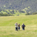
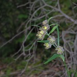
That Volvons were active traders does not mean their territory was short on natural resources. The name ‘Volvon’ itself roughly translates as “natural springs,” which befits a triblet based in the Black Hills where the headwaters of a number of perennial creeks rise. The highland heart of Volvon territory today is rich in oak, pine, and manzanita. Mount Diablo is home to a number of endemic plant species–rare resources controlled by Volvons. Open rangelands, now mostly overrun with nonnative grasses, must once have been covered with food-bearing plants. Deer, elk, and antelope were no doubt abundant in the lighly settled ridges and valleys on the eastern side of the territory.
Volvon territory gives every appearance of once having supported a substantial population. We have discovered 81 bedrock mortar sites, and over 2,100 bedrock mortars. Each site carries its own sense of place and is an individual window into the past. As you walk the paths that connect these sites and build up a richer mental map and sense of the landscape, you may acquire a feeling for the possibilities of life in Volvon territory in the not so distant past.
There are magical and metaphysical powers associated with Mt. Diablo and the Black Hills. Go there now and experience its effect on your perspective. Steep yourself in prehistory. The Spanish extirpated the Volvons from their homeland 200 years ago, but physically, their territory remains virtually intact today. The land still has a life of its own.
Highland Ridge LookoutOne probable bedrock mortar.The western escarpment of Highland Ridge reinforces the fortress feeling the Black Hills provide.It is unlikely that any group of people ever snuck up on the Volvons.
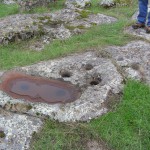
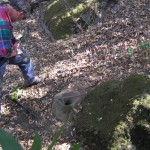
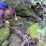
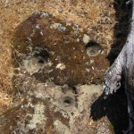
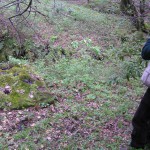
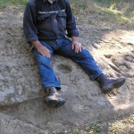
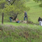
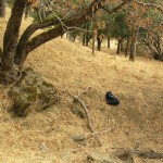
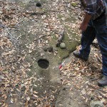
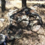
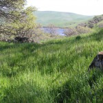
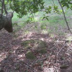
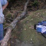
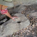
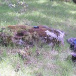
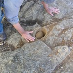
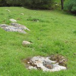
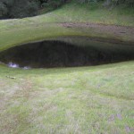
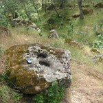
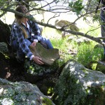
Lower Highland Ridge PondFive bedrock mortars: On one rock: 2 semi-conical bedrock mortars, 1 of which is deep, one definite broken mortar and one possible broken mortar; 2 conical bedrock mortars on a rock slab in the creek west of the pond.Elevation 2065 ft.A view of the mortar rock and the nearby pond. This is […]
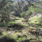
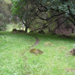
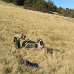
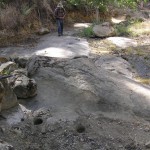
Mid Silva Creek Terrace11 bedrock mortarsElevation 1101 ft.Thanks to Joel for discovering this beautiful, protected site.Looking down on the site with Los Vaqueros Reservoir in the background. Beyond the hills of the Vasco lies the San Joaquin Valley and the Sierra Nevada.Looking into the site.The mortars are strung out on a terrace along the creek.A […]
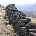
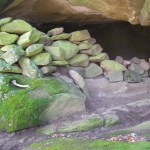
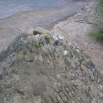
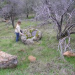
Round Valley Village317+ bedrock mortars, two cupule rocks, and a stacked rock enclosure.CA-CCO-320This settlement is the largest of three that sit along the eastern base of the Black Hills.Joseph Chartkoff in “A Rock Feature Complex from Northwestern California,” American Antiquity, Vol. 48, No. 4, (Oct., 1983), pp. 745-760, notes the similarity between this stacked-rock enclosure […]
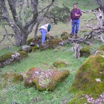
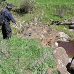
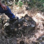
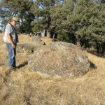
Upper Marsh Creek Tributary3 bedrock mortars, slick and cupule.Jim and Bob examine a rock.A water wonderland.A checker lily blooming just off Coyote Trail.
Canyon Milling siteTwenty-nine bedrock mortars, three probable bedrock-mortars.Ten small mortars on one rock could be considered cupules.Elevation 1477 ft.Our name for this site comes from Table 1 of the 1992 report Evaluation, Request for Determination of Eligibility, and Effect for the Los Vaqueros Project.A partial view of the site.Photograph by Bob BardellA closer look at […]
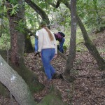
Hog Canyon6 bedrock mortars and 1 portable mortar in Hog Canyon.The route up Hog Canyon from Marsh Creek was one of the main entryways to the Volvon heartland. This site is right on that trail.Jim examines the portable mortar. Bob looks toward a toward a bedrock mortar on a tipped over rock.
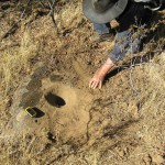
Lower Mallory Creek2 bedrock mortars and 1 possible mortarElevation 533 ft.Thank you Master Site Finder.Bob straddles the upper mortar of a pair. It’s a comfortable working position.A closer look at the mortars. Both are small cones with hi/lo rims.Be sure to continue up the creek until you reach a group of mortars on a bedrock […]

Morgan Territory Ridge East Shelf #1One bedrock mortar, one anvil, and the ruins of an historic structure.Elevation 1580 ft.We marveled at the snow-capped Sierra Nevada when we first visited this site in the Spring of 2011. That’s Los Vaqueros dam in the background with water in the reservoir drawn down in preparation for the expansion […]
SE Mallory Ridge4 bedrock mortars, 2 possible metatesElevation 1867 ft.Doc Hale says the holes at this site are real mortars, not geoconcretions. That’s good enough for us.