The Volvon were one of the Bay Miwok tribelets living in Contra Costa County at the time of European contact. They were a hill people based in the rugged Black Hills southeast of Mt. Diablo. The mountain itself was in Volvon hands. It had been the home of the supernatural First People, who created Indians and their world, and was a spiritual focus for nearly every tribe that could see it. Shamen and religious leaders went to the mountain to pray. Everyday people would visit its slopes for intertribal festivals. This meant the Volvon must have been a prosperous people. One did not just sashay into Volvon territory without bearing tribute for the privilege. Imagine the trade goods the Volvons acquired this way. They were regular participants in regional trade festivals hosted by their Ohlone neighbors, the Ssaoams, at the Brushy Peak trading grounds not far from the Altamont Pass. The Volvons’ preeminent position at the crossroads of Central California no doubt made them a sophisticated and cosmopolitan people.
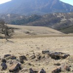
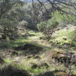
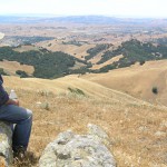
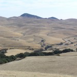
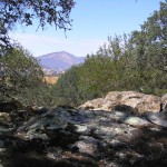
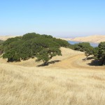
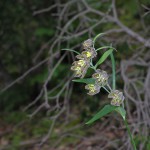
That Volvons were active traders does not mean their territory was short on natural resources. The name ‘Volvon’ itself roughly translates as “natural springs,” which befits a triblet based in the Black Hills where the headwaters of a number of perennial creeks rise. The highland heart of Volvon territory today is rich in oak, pine, and manzanita. Mount Diablo is home to a number of endemic plant species–rare resources controlled by Volvons. Open rangelands, now mostly overrun with nonnative grasses, must once have been covered with food-bearing plants. Deer, elk, and antelope were no doubt abundant in the lighly settled ridges and valleys on the eastern side of the territory.
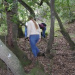
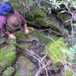
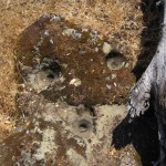
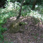
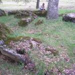
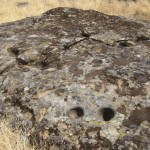
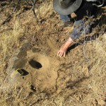
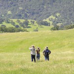
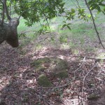
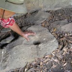
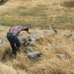
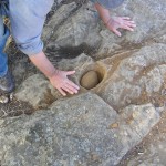
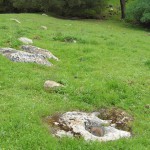
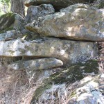
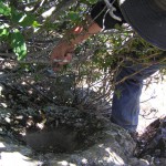
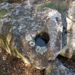
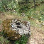
Volvon territory gives every appearance of once having supported a substantial population. We have discovered 81 bedrock mortar sites, and over 2,100 bedrock mortars. Each site carries its own sense of place and is an individual window into the past. As you walk the paths that connect these sites and build up a richer mental map and sense of the landscape, you may acquire a feeling for the possibilities of life in Volvon territory in the not so distant past.
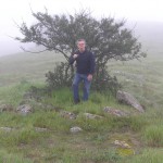
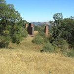
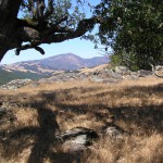
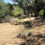
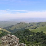
There are magical and metaphysical powers associated with Mt. Diablo and the Black Hills. Go there now and experience its effect on your perspective. Steep yourself in prehistory. The Spanish extirpated the Volvons from their homeland 200 years ago, but physically, their territory remains virtually intact today. The land still has a life of its own.
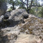
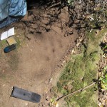
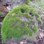
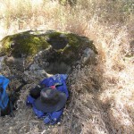
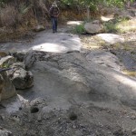
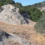
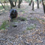
Volvon Village on Mallory Creek 715 bedrock mortars and countless housepits spread over a half mile. Cupule rock. This village, located in the highlands of the Black Hills, must have been one of the largest settlements in the prehistoric Bay Area, yet it was, apparently, unknown to early archaeologists and historians. It does not appear […]
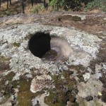
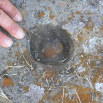
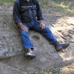
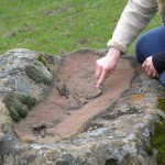
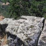
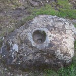
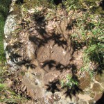
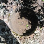
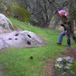
Blue Oak Trail16 bedrock mortars above Blue Oak Trail.This is a sweet campsite with a secluded feel even though it’s right above Blue Oak Trail and a stone’s throw from the Lion’s Mane Village.The bowl mortar here is about the size and shape of a small mixing bowl–8 1/2″ in diameter–and a little over 6″ […]
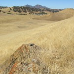
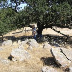
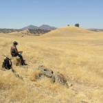
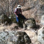
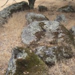
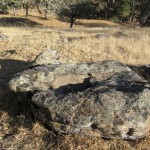
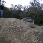
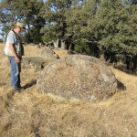
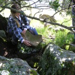
Founders Ridge2 bedrock mortars and 1 broken mortarElevation 2498 ft.We’ve walked along this ridge a bunch of times, but we weren’t checking out the rocks with Jeff’s sharp eyes.Looking east with the main mortar rock in the foreground. We could see the snow-capped Sierra in the distance. Unfortunately, this picture didn’t capture the view.These are […]
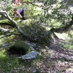
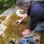
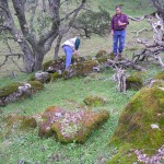
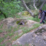
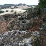
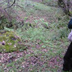
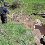
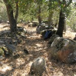
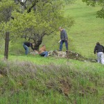
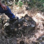
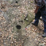
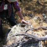
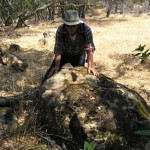
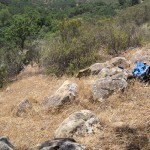
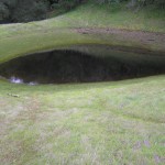
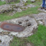
Los Vaqueros Pond Village130 bedrock mortars and 4 slicks.CA-CCO-461Elevation 642 ft.The pond here is often dry. Nearby Adobe Creek would have provided year-round water to this village.Jim among grinding rocks and housepits.A view of the streamside terrace on the south bank of Pond Village Creek. At least three mortar rocks are visible in this photograph. […]
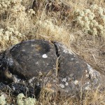
Manzanita Ridge2 probable bedrock mortarsElevation 1461 ft.The ridge southeast of Bob’s Mortar is covered with Manzanita. These mortars may have started life as geoconcretions.
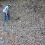
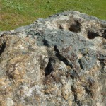
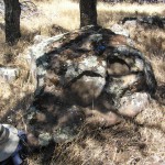
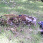
Riggs Canyon Rock Camp113 bedrock mortars in a beautiful picnic site.Elevation 1306 ft.The Riggs Canyon Rock is a wonder. It is covered with more than 40 mortars, many of them ground into the base of geoconcretions. (In a geoconcretion a harder rock embedded in a softer rock is extruded over time due to various forces. […]
Trail Through Time27 bedrock mortars near a wayside exhibit along the Trail Through Time.Elevation 1665 ft.There are serious kitchen rocks here.A nice little exhibit with a map to most of the bedrock mortars at this site.
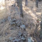
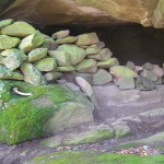
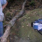
Bob Walker’s Cave1 bedrock mortar, rock shelter, stacked rocksElevation 2147 ft.The late Bob Walker was an environmentalist, photographer, and president of the San Francisco Bay Chapter of the Sierra Club. During his tenure there he pushed for the expansion of Morgan Territory Regional Preserve and saw its acreage increase from 970 to more than 5,000 […]
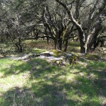
Green’s Village in Fig Pig Gulch75+ bedrock mortars; housepits.Elevation 716 ft.Jeff discovered this beautiful village on a Thanksgiving morning (!) reconnaisance hike. A great find, Jeff. The village extends over a wide area, and, like the Volvon Village, could be viewed as a collection of separate sites. We prefer the holistic view. About half the […]
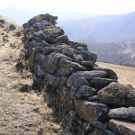
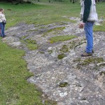
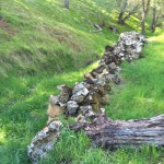
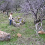
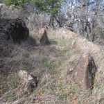
Louise’s WalkwayRock feature. Two bedrock mortars nearby.Here is another spot Louise Lacey turned us on to. It’s a great place to hang out and be alone with the world.Parallel rock alignments like Louise’s Walkway turn up elsewhere in Morgan Territory Regional Preserve.Rocks at the open ends of this alignment give it the aura of a […]